The purpose of the TU-Black Sea project is to develop and implement ecosystem models as a management tool for improving the health of the Black Sea, and to help build the capacity within the Black Sea coastal countries for high quality oceanographic measurement and analysis capabilities for carrying out long-term monitoring of the Black Sea following the completion of the project.
One of the main project objectives is to establish a database management system (DBMS) in all Black Sea countries, for environmental and oceanographic data pertinent to the goals of this program. This DBMS has been already developed and distributed amongst participants of the project. There exist some restrictions on data usage till 2001 year, but metadata information is distributed freely. NATO TU-Black Sea Data Inventory provides metadata on both data loaded into the DBMS and data available but not still included into the database.
All collected data are grouped into data sets. A data set is a set of stations. It has a start and finish date, name and brief description. A data set belongs to some institution. Usually, a data set contains data of a research vessel cruise. Station is a point located in space and time where some oceanographic measurements were carried out. It is characterized by its name, time, coordinates, and sea depth. The name is a text string containing no more than eight characters. The day, hour, minutes and sea depth may be unknown. A station can belong to the only data set.
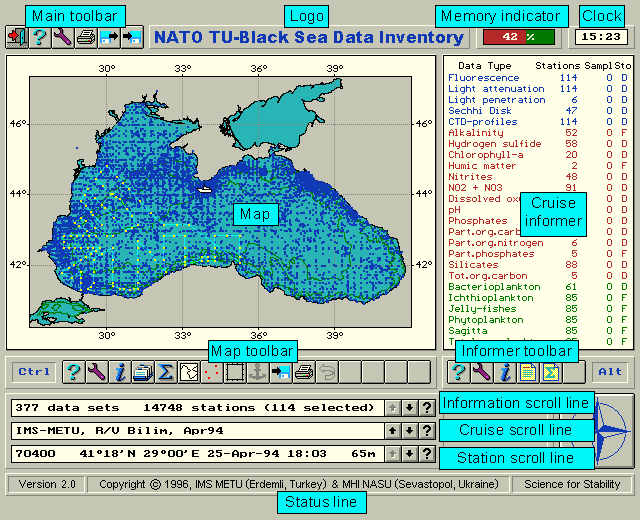
Inventory contains information about data collected in data sets. You can see how many stations were carried out for each parameter measured in a data set. Some data contributors, usually biologists and chemists, passed information about the amount of samples (casts), but not on the amount of stations. This summary is displayed at the right part of the screen for the current data set. Current data set and station are displayed at the bottom part and are marked out on the map by color.
It is possible to navigate through data sets and stations with the help of keyboard or mouse clicking on the map. The information about the current data set and station is displayed instantly.
A user can select data sets on time, region, country, institutions, measured data, etc. Only selected data sets are displayed.
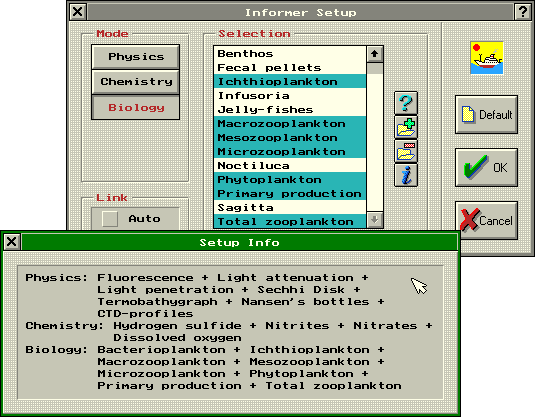
Data included into Inventory are divided into three groups: Physics (13 variables); Chemistry (24 variables) and Biology (14 variables).
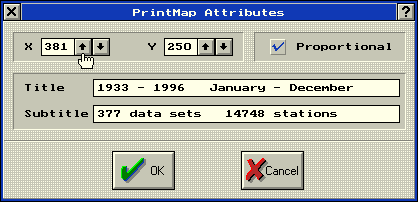
Inventory contains information about 377 data sets (8 scientific institutions, 33 research vessels, 14748 stations, 51 variables).
Inventory provides a set of powerful and convenient tools to manage data:
The next features provides a user some convenience:
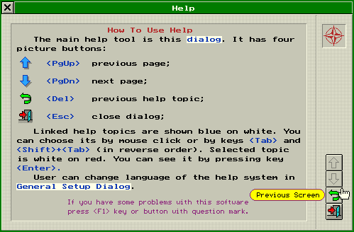
The context-sensitive on-line help is available. It is realized as a hyper-text with graphics images.
Few ways to navigate through data sets and stations are realized:
The current data set and station are kept during map zooming and saved to desktop file.
It is possible to select data sets on the next items:
Complex selection rules can be easily constructed. Zooms made in the map operate as selection on region.
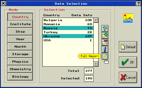
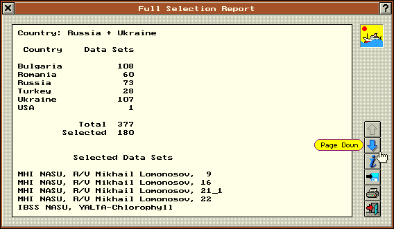
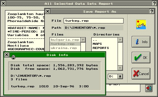
A report about the selection made is available. It can be printed or saved to a file.
A brief information about actual selection is also available.
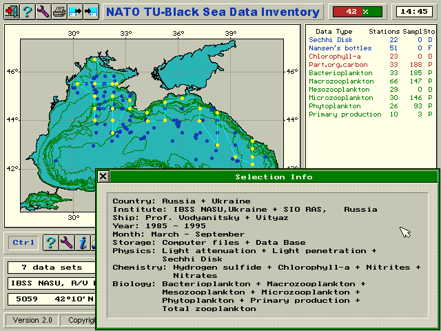
This tool is the main presentation tool. A small marker on the map indicates locations of stations, which are combined for cruises. The current data sets and station are marked out by color. This tool allows the following possibilities:
This feature allows to select any region on the map. An original algorithm realizes this operation instantly even on slow computers.
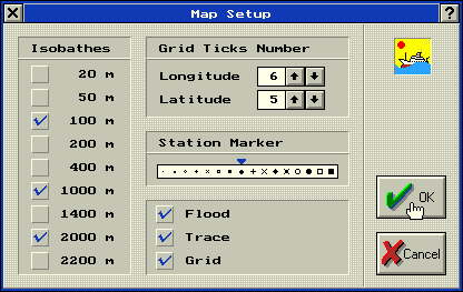
Coastline and isobaths were obtained from: IOC, IHO, BODC, 1994, GEBCO Digital Atlas CD-ROM, British Oceanographic Data Centre, Proudman Oceanographic Laboratory, Bidston Observatory, Birkenhead, Merseyside L43 7RA, United Kingdom.
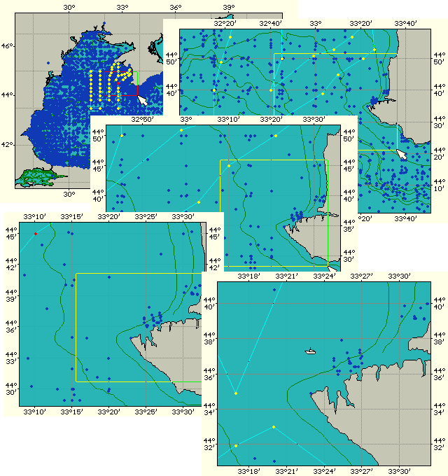
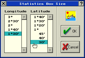
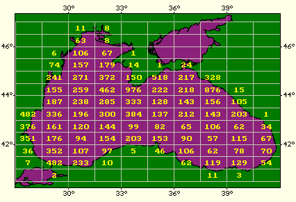
Sometimes it is useful to get the information on so-called data availability - how many stations have been taken in various geographical regions. The map tool is very convenient for such purpose. You can choose the box size for statistical calculations at corresponding dialog window.
Results displayed on the map can be saved & printed.
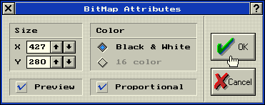
It is possible to save the map as standard Windows bitmap file.
It is possible to print the map using standard DOS utility GRAPHICS.COM.
You can customize the map tool on your preference. All settings made are stored to desktop files.
The main task of Inventory is to provide information about data sets (cruises). A brief information for the current data set (name, time, station locations, amount of data collected) are displayed at the cruise scroll line, map and informer. The more detailed information can be reported separately.
This tool is placed at the right part of the screen and displays a brief information about amount of data measured in the current data set. All oceanographic variables are arbitrary grouped into three sections (Physics, Chemistry and Biology). These groups are marked out by corresponding colors. It is possible to display information only about assigned variables. These settings are saved to the desktop files.
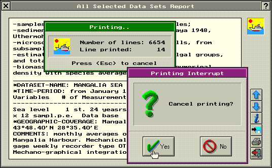
Inventory provides the brief descriptions for all data sets. This description contains information about data measured, used methods and devices, etc. Reports are generated as for the current data set as for all selected data sets.
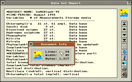
These reports can be saved to files or printed.
There are two levels of Inventory customizing: low and high ones. The low-level configuration file SYSTEM.CFG is read every time the application starts. It contains some general features of the application performance. These settings are made in the corresponding dialog window.
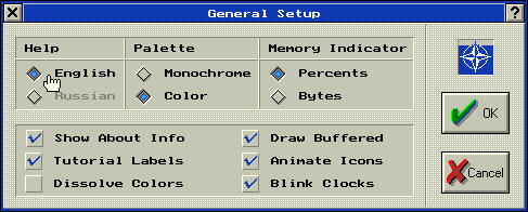
Some features of reports printing are also saved to configuration file SYSTEM.CFG.
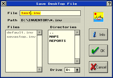
The high-level customizing options are saved to desktop files which can be load on a user's request. These files contain information about the current data set and stations, data sets selection, map and informer customizing, etc.
This software was developed at the Data Base Laboratory of Marine Hydrophysical Institute (National Academy of Sciences of Ukraine) jointly with the Institute of Marine Sciences (Middle East Technical University).
| DBL MHI | IMS METU | |
|---|---|---|
| Address | 335000, Marine Hydrophysical Institute, 2, Kapitanskaya Street, Sevastopol, Ukraine | Institute of Marine Sciences, P.O.Box 28, 33731, Erdemli, Ichel, Turkey |
| Fax | +380(692)444253 | +90(324)5212327 |
| database@alpha.mhi.iuf.net | sukru@ims.metu.edu.tr |
NATO TU-Black Sea Data Inventory is freely distributed.
Load archive inventor.zip (size 633K), place it in a separate directory (C:\INVENTOR, for example) and unpack. Use batch-file START.BAT to run Inventory under DOS. Read contents of README file to install software properly under Windows.